Welcome to the Presentation
Sustainable development in the Göta Älv area of 2050
- presentation of three scenarios-
What could the river area look like in 2050? how do you go to different places, where do you meet your friends, and how do you create your own venture? do we still have enough resources in 2050 to cover our daily needs? or most imporantly, do we have a happy life where we all consume equal opportunities of life while taking best care of our mother nature?
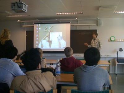
Welcome to the final presentation of the course Project management on sustainable development.
We are students from different academic background who have been working on a project where we are creating scenarios for sustainable development in the river area of Gothenburg for the year 2050. The project is a collaboration between the University of Gothenburg and Chalmers.
The final presentation on this project will take place on-
Date: 3rd of June, from 15:00 to 17:00,
At: School of Global Studies (Annedalsseminariet),
Room No. SA 302
Address: Campus Linne (Seminariegatan)
Looking forward to see you there!
Discussing and Presenting literature
During our second and third week we were all given two texts to read, one that we present and the other to prepare questions. Basically the text will be our theoretical or and research departure point so it is important for use to share each other our own understanding of the text and its value for our project. We also point out which part that are interesting and important points of the text we might find useful for the projects.
The presentation was held on 8,9,12,13 April 2010 in the Mark Room, Geovetarcentrum.
Below is the list of literatures we discussed. Furthermore we will post the review of the literature or attach them so you can download them.
Posted by: Aditya Muharam
List of Literature
Climate change, risk and adaptation
1. SMHI (2006). Klimatunderlag för sårbarhetsanalys Göteborgs stad – Etapp 2, sannolikhets och riskbedömningar. SMHI. Rapport Nr. 2006:16.
2. Schneider, S.H., S. Semenov, A. Patwardhan, I. Burton, C.H.D. Magadza, M. Oppenheimer, A.B. Pittock, A. Rahman, J.B. Smith, A. Suarez and F. Yamin (2007). Assessing key vulnerabilities and the risk from climate change. Climate Change 2007: Impacts, Adaptation and Vulnerability. Contribution of Working Group II to the Fourth Assessment Report of the Intergovernmental Panel on Climate Change, M.L. Parry, O.F. Canziani, J.P. Palutikof, P.J. van der Linden and C.E. Hanson, Eds., Cambridge University Press, Cambridge, UK, 779-810. http://www.ipcc.ch/publications_and_data/ar4/wg2/en/ch19.html
3. McLaughlin, P. and Dietz, Thomas. (2008). Structure, Agency and Environment: Toward an Integrated Perspective on Vulnerability. Global Environmental Change 18 (1): 99 – 111.
4. CSIRO, Arizona State University, University of Stockholm (2007). Urban Resilience. Research Prospectus. Resilience Alliance. http://www.resalliance.org/files/1172764197_urbanresilienceresearchprospectusv7feb07.pdf
5. ICE (2010). Facing Up to Rising Sea Levels. Retreat? Defend? Attack? ICE. http://www.buildingfutures.org.uk/
Transdisciplinary theory and methodology
1. Geels, F. W. (2010). Ontologies, socio-technical transitions (to sustainability), and the multi-level perspective. Research Policy (Article in Press).
2. Steven Cork et al. (2005). 4 Scenarios. Chapter 8 in Ecosystems and Human Well-being: Scenarios.
http://www.millenniumassessment.org/documents/document.332.aspx.pdf
3. Scholz, R. W. & Tietje, O. (2002). Embedded case study methods. Integrating quantitative and qualitattive knowledge. Thousand oaks: Sage. (Especially Chapter 4: The Architecture of Knowledge Integration in Embedded Case Studies, Chapter 9: Formative Scenario Analysis, Chapter 11: Multi-Attribute Utility Theory, and Chapter 12: Integrated Risk Management).
4. Polk, M., Knutsson, P. (2008). Transdisciplinary research for promoting social change towards sustainable development. Environmental Education Research 14 (6): 643 – 653.
5. Halla, F. (2007). A SWOT Analysis of Strategic Urban Development Planning. The Case of Dar Es Salaam City in Tanzania. HABITAT International Vol. 31 (1): 130 – 142.
Sustainable Urban Development
1. Hopwood, B., Mellor, M., O’Brien, G. (2005). Sustainable Development: Mapping Different Approaches. Sustainable Development 13: 38 – 52.
2. Kates, R. W., Parris, T. M., Leiserowitz, A. A. (2005). What is Sustainable Development: Goals, Indicators, Values and Practice. Environment: Science and Policy for Sustainable Development 47 (3): 8 – 21.
3. Rockström, J. et al. (2009). A safe operating space for humanity. Nature 461 (24): 472 – 475.
4. HUR 2050. (2005). Framtidsbilder av en Långsiktigt Hållbar Göteborgsregion omkring år 2050. HUR 2050.
5. Andersson, R., Bråmå, Å., Hogdal, J. (2009). Fattiga och Rika – Segregerad Stad. Flyttningar och segregationens dynamik i Göteborg 1990 – 2006. Göteborgs stad.
6. Andrea Colantonio. (2007). Measuring Social Sustainability: Best Practice from Urban Renewal in the EU. The European Investment bank. http://www.brookes.ac.uk/schools/be/oisd/sustainable_communities/resources/SocialSustainability_Metrics_and_Tools.pdf
Environment, Energy and Transport
1. Regeringskansliet (2000). The Swedish Environmental Objectives. Interim Targets and Action Strategies. Summary of Gov. Bill 2000 / 01:130. Regeringskansliet. http://www.sweden.gov.se/content/1/c6/02/00/34/d7a3cf4f.pdf
2. Yan Zhang, Zhifeng Yang, Xiangyi Yu (2009). Evaluation of urban metabolism based on emergy synthesis: A case study for Beijing (China). Ecological Modelling Vol. 220 (13 - 14): 1690 – 1696.
3. Göteborgs Stad (2009). Miljörapport 2008. En beskrivning av miljötillståndet I Göteborg. R 2009:11. Miljöförvaltningen, Göteborgs Stad. http://www5.goteborg.se/prod/Miljo/Miljohandboken/dalis2.nsf/vyFilArkiv/N800_R2009_11.pdf/$file/N800_R2009_11.pdf
4. Folke, C. (2006). The Emergence of a Perspective for Social-Ecological Systems Analyses. Global Environmental Change 16: 253 – 267.
5. Åkerman J et al. (2007). Två gradersmålet i sikte? Scenarier för svenska energi- och transportsystmet till år 2050. Rapport 5754 Naturvårdsverket. http://www.naturvardsverket.se/Documents/publikationer/620-5754-1.pdf
Excursion as part of project
By: Samira Heshmatzadeh
Many people are considered to be variable knowledge about the state of affairs in a DISTINCT or geographic socio-cultural area. Whenever something of Importance that happens upon their concerns domain, they are to be likely be called upon to explain or interpret the events publicly. In this term they start to find the issues and objectives by observing the area, as we did in our project.

The fact is that all projects log in research, observation, and collection of materials. Excursion as one way suggested data collecting and getting familiar with problem area by observing the problem area. Direct way commands as another way is information gathering, Sequence of Operations That Enabler the user to learn the commands Which change his data sets. The Distinction between the excursion and the direct way is because of the distinction between there plan and performance, or between knowing and doing. So the best way of doing comprehensive research is to combine different type of data gathering.

On the 30 th March 2010, as the first step of starting our project, we start to observe the area of our study in five diffferent groups, EACH were responsible for part of area specified by documenting the day with photo and prepare a presentation.
So the first group's points of interest was:
· Angered bridge
· Area Planned for new tunnel
· Marieholm bridge.
For the second group was:
· Backaplan (Development Area)
· Ringön and Trains chunting yard close by
· DHL terminal and Gullbergsvass kay area.
Third group were Responsible for:
· Älvrummet (exhibition about the River City)
· Biskopsgården
· wharf.
Forth Group to observed:
· Rock - Älvsnabben
· Färjenäs
· Sannegårdshamnen
· Stena terminal.
Finally the load group observed:
· Amf4 military area - as a potential area for new development
· Risholmen / Heart Holmen
· Kungsten / Älvsborgsbron bridge.
By observing the area, the strengths and weakness as well as potential and future possibilities of the area could be understandable more tangibly. After That observation EACH groups presented their own understanding of that area of the whole members. For example the first group started by their observation at Angered, passing the bridge, taking photos and discussing the strengths and weakness of that area, try to draw reason for them, like the inaccessibility to the river side, no social meeting place, non residential friendly and so on. They also "mentioned thats the linkage between both sides of the river was so weak and there was a new project of building a new tunnel completely close to the old one which seem questionable. They also "found thats the density of the area from the east side was so diffused and as you go more along the river up to center it was sensed both for residential and industrial area with these objectives. They came to this conclusion, that what would be the benefits as well as loss of Sustainable Development on that area.
Göteborg, a short introduction.
An old Swedish saying holds that a child that is loved has many names. Göteborg, Gothenburg, Gotemburgo, Gautaborg … I am counting. Well, this child is loved by many. Therefore it is our way to express a love to a child by preparing future sustainable development.
But first a bit of very short introduction taken from several sites:
Greater Gothenburg, is a metropolitan area surrounding the city of Gothenburg in Sweden. The metropolitan region is located in Västra Götaland County, except for the municipalities of Kungsbacka, which is located to the south in Halland County. As of 2005, the municipality of Alingsås and Lilla Edet were added to the region. With the current population of nearly one million individuals it is the second largest metropolitan area in Sweden after Metropolitan Stockholm.

Meanwhile the City of Gothenburg (Swedish:Göteborg), is the second-largest city in Sweden (after Stockholm) and the fifth-largest in the Nordic countries. Situated on the south-west coast of Sweden, the city has a population of around half million people. The city was founded in 1621 by King Gustaf Adolf of Sweden. It is situated by the sea at the mouth of Göta Älv-the river running through the city-and is the largest sea port of the Nordic countries.
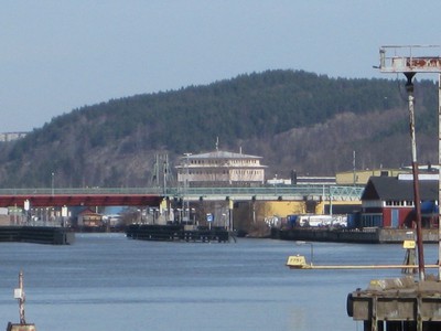
Our focus of interest in this project will be the the future Gothenburg sustainable development of around the Göta Älv (Göta River).
The Göta älv is a river that drains lake Vänern into Kattegat at the city of Gothenburg on the western coas Kattegat at the city of Gothenburg on the western coast of Sweden. It is located in Götaland, with the river itself being a site of early Geatish settlement. The length is 93 km. Often the combination of Göta älv and Klarälven (a river ending at Vänern) is mentioned. This combination is the longest river in the Nordic countries, 750 km. The Bohus Fortress is located by the river at Kungälv. Here the river splits into two, with the northern part being the Nordre älv and the southern part keeping the name Göta älv.
Meanwhile for this project the preliminary limitation of the river area is between Angered Bridge down to the mouth of the river in the western part of Gothenburg.
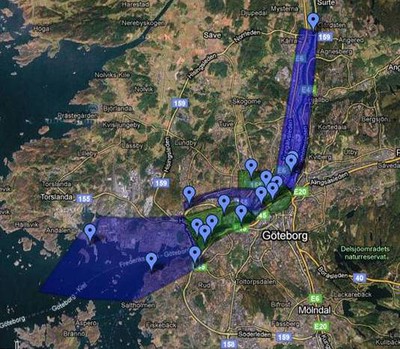
At a glance the area has a complex and different landscape; housing, industries, transportation infrastructures; mixed with different interests and values. Therefore it is fair to say, it will be an interesting and challenging project to nurture the child we love into a better future.
Aditya Muharam
Source: Wikipedia, Googlemaps, Goteborg.com
